Welcome to
Professional Drone Shop & Commercial Drone Services in Linn, MO
Aerovision Drone LLC is your local partner for precision aerial solutions — from drone spraying and agricultural crop spraying to livestock and pet recovery, airborne mapping, and high-resolution aerial photography. Based at 398 Route CC, Linn, MO 65051, we combine industry-leading drone technology, FAA-compliant operation, and years of experience in agricultural and commercial drone applications to deliver measurable results for farmers, land managers, and commercial clients across Missouri and surrounding states. Call (573) 578-5005 to schedule a consultation or request a quote today.
Why Aerovision Drone LLC Matters
In 2025 the future of land management, agriculture, and emergency recovery increasingly depends on efficient, safe, and scalable aerial services. Traditional methods — ground-based spraying, manual mapping, and time-consuming searches — can be inefficient, costly, and sometimes dangerous. Aerovision Drone LLC addresses those gaps by delivering faster, more precise, and environmentally responsible solutions. Our drones reduce chemical usage through targeted application, cover large areas quickly, gather accurate data for better decisions, and respond rapidly to animal recovery needs. Whether you’re a cattle producer needing rapid deer recovery assistance, a row-crop farmer seeking efficient crop spraying, or a landowner wanting detailed maps and aerial photography, our services save time and money while improving outcomes.
Key Benefits You’ll See Immediately
Precision Application
Drone spraying delivers targeted pesticide, herbicide, and nutrient application with minimal drift and reduced waste compared with ground rigs.
Time Savings
Cover large fields, pastures, or properties in a fraction of the time it would take traditional equipment.
Cost Efficiency
Reduce labor, lower fuel consumption, and optimize input use for stronger ROI.
Safety and Accessibility
Reach inaccessible areas and steep ground without putting operators at risk.
Data-Driven Decisions
High-resolution mapping and imagery give you actionable insights for yield optimization and pasture health.
Rapid Recovery Response
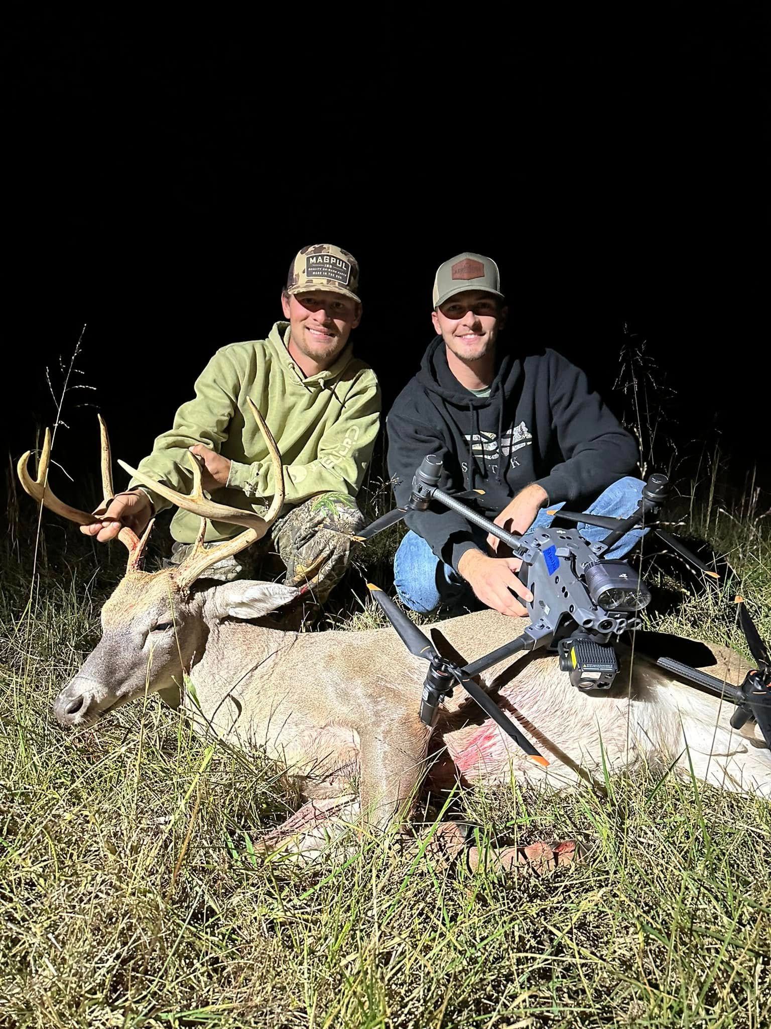
Our deer and livestock recovery capabilities reunite livestock and pets with owners quickly, minimizing stress and loss.
How Aerovision Drone LLC Can Help
We provide tailored services to meet the specific needs of each client. Our approach begins with a detailed consultation, followed by a site visit or planned flight, data collection, service execution, and post-operation reporting. We operate fully insured, FAA-compliant flights with trained drone pilots and technicians. Our equipment is maintained to the highest standards to ensure consistent coverage and accurate application rates.
Commercial Drone Services We Offer:
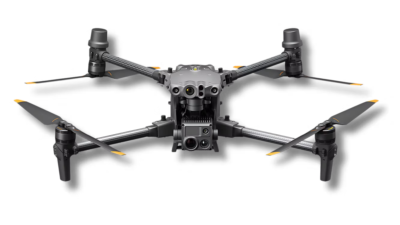
Drone spraying and agricultural spraying for crops and pastures
Broadcast seeding for pasture renovation and reclamation
Deer recovery and livestock/pet recovery services
Aerial mapping and herd analysis using NDVI and other vegetative indexes
High-resolution aerial photography for land documentation and marketing
Drone operator/pilot for hire for commercial projects and inspections
Custom drone application programs tailored to your field, crop, or property
Service Delivery Process
1.
Consultation and Planning
We listen to your goals — yield increases, pasture rejuvenation, pest control, or search and recovery — then design an aerial plan that optimizes coverage, chemical mixtures, and flight paths.
2.
Regulatory Compliance
We manage permits, follow EPA guidelines for agricultural applications, and ensure all flights meet FAA Part 107 and local regulations.
3.
Precision Execution
Our drone pilots execute flights with precise altitude, speed, and nozzle settings to achieve accurate application rates and complete coverage.
4.
Verification and Reporting
After the job, we deliver a flight report including maps, applied rates, imagery, and recommended next steps based on the data collected.
5.
Follow-up Support
We remain available for follow-up flights, repeated applications, or additional mapping as your season evolves. And as always, you can reach out to us if something comes up.
Why Choose Aerovision Drone LLC Over Alternatives
Local Expertise
Based in Linn, MO, we understand regional crops, pests, and landscape challenges.
Experienced Pilots
Our operators are skilled in agricultural spraying, mapping, and recovery operations.
Safety and Insurance
Fully insured operations and robust safety protocols protect you and our team.
Modern Fleet
We deploy current drone platforms optimized for payload capacity and reliable GNSS-guided flight paths.
Transparent Pricing
Clear, competitive pricing with project-based and per-acre options to fit different budgets.
Comprehensive Reporting
We provide not just application but the data insights you need for future planning.
What to Expect on Your First Job
Pre-Flight Assessment: We evaluate your property, weather windows, and needed materials.
Customized Flight Plan: Based on your objectives we create a flight map balancing speed and application accuracy.
On-Site Execution: Our team will arrive, set up the drone and materials, conduct safety checks, and carry out the operation.
Post-Operation Debrief: You receive a comprehensive report with imagery, maps, and recommendations.
Industry Applications
Row Crops: Corn, soy, wheat, and specialty crops benefit from targeted aerial spraying and mapping.
Pastures and Hayfields: Fast, efficient pasture spraying and broadcast seeding for improved forage.
Livestock Operations: Rapid recovery and tracking for livestock and pets; herd analysis and mapping for grazing management.
Land Management: Site restoration, invasive species control, and reclamation seeding.
Commercial: Construction site monitoring, inspection, and marketing photography.
FAQ — Common Questions from New Clients
Are your drone spray applications legal and safe?
Yes. We follow EPA regulations, adhere to label instructions for all products used, and conduct operations under FAA rules with insured, trained pilots. Safety is our top priority.
How much area can you cover in one flight?
Coverage depends on drone model, payload capacity, and application rate. Typical single-drone passes can cover several acres per battery cycle; we deploy multiple flights or multiple drones for larger jobs to complete work efficiently.
How are application rates verified?
We calibrate nozzles and verify droplet size and volume before each job. Post-flight, we provide an application report showing effective rates and coverage.
What if weather delays operations?
We monitor weather windows and will reschedule to the earliest safe opportunity. Wind, temperature, and humidity affect application decisions and product behavior.
How quickly can you respond for a deer recovery?
Response times vary with location but our local base allows us to mobilize quickly. We prioritize rapid deployment to minimize time animals spend away from owners and to increase recovery success.
book now
Contact Us
We will get back to you as soon as possible.
Please try again later.
Contact Us
For consultations, quotes, or to schedule services, call (573) 578-5005 or visit us at 398 Route CC, Linn, MO 65051. You can also request service details and pricing via phone. Let Aerovision Drone LLC transform how you manage land, livestock, and crops with professional drone solutions.